Skip Navigation Link www.nws.noaa.gov  
NOAA logo - Click to go to the NOAA homepage National Weather Service   NWS logo - Click to go to the NWS homepage
Hydrometeorological Design Studies Center - Precipitation Frequency Data Server header logo


NOAA Atlas 14 Cartographic Maps of Precipitation Frequency
Estimates for Selected Frequencies and Durations

carto_map_US
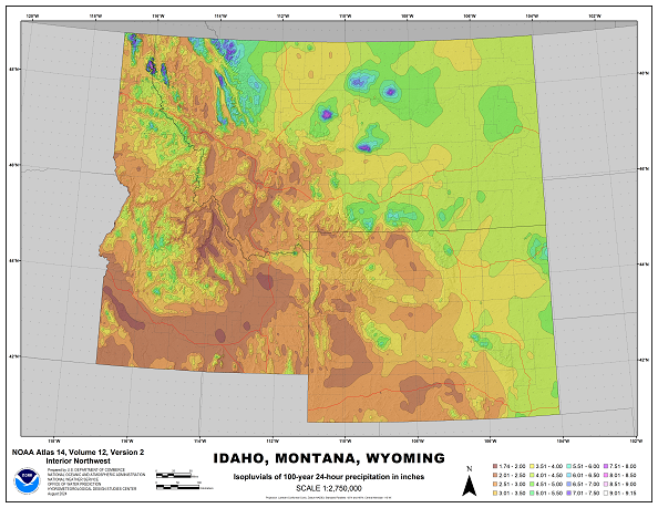
Cartographic map example.

This web page provides access to NOAA Atlas 14 cartographic maps of precipitation frequency estimates in the PDF format for selected average recurrence intervals (ARIs) and durations (shown in the table below). We recommend that these maps are used as visual aids only. Precipitation frequency estimates can be obtained from the high resolution grids available from the PFDS interface. See corresponding NOAA Atlas 14 document for more details.

ARI Duration
(years) 60-min 6-hr 24-hr 2-day 10-day 30-day 60-day
2
5        
10        
25        
50        
100

 DOWNLOAD MAPS:

State:
Average recurrence interval:
Duration:


Main Link Categories:
Home | OWP

US Department of Commerce
National Oceanic and Atmospheric Administration
National Weather Service
Office of Water Prediction (OWP)
1325 East West Highway
Silver Spring, MD 20910

Page Author: HDSC webmaster
Page last modified: April 21, 2017
Disclaimer
Credits
Glossary
Privacy Policy
About Us
Career Opportunities